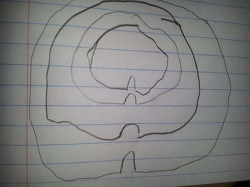
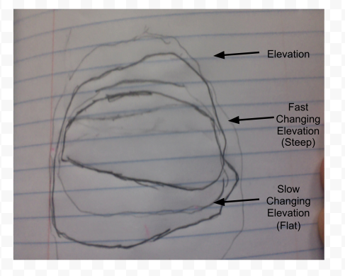
Topographic Maps
The different lines show the changes in elevation: for example, the lines closer together show that elevation changes quickly, and it is very steep. The lines farther about show that elevation changes slowly. These lines are called contour lines. The "V' represents weathering occurring at mountains.
MAP:
MAP:
MAP WITH RIVER: